 Dewa Sanzan
What is the Dewa Sanzan?
The Dewa Sanzan ("the Three Mountains of Dewa"), encompasses three sacred peaks: Mt.Haguro (414 meters high), Mt. Gassan (1,984 meters high), and Mt. Yudono (1,500 meters high) inside the national park of Bandai-Asahi. For over 1,400 years, these mountains have been venerated by practitioners of Shugendo, a unique syncretic faith blending ancient mountain worship, Shinto, and esoteric Buddhist beliefs.
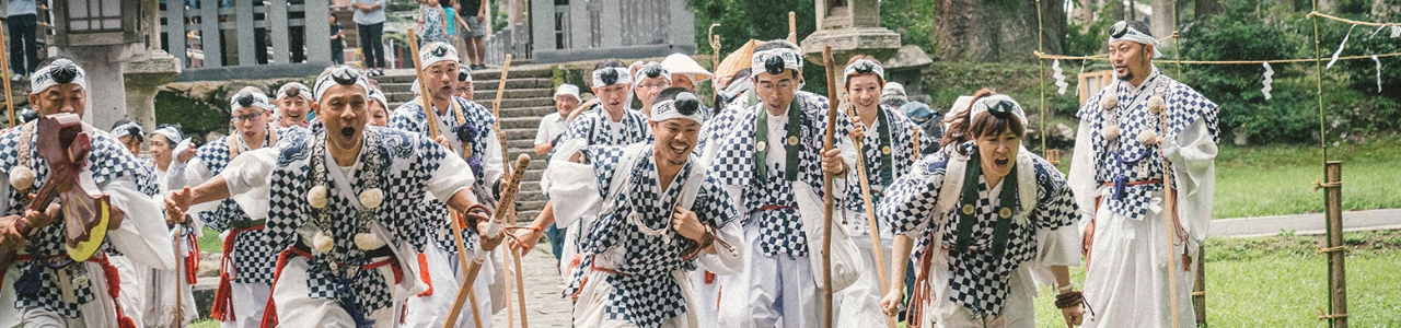
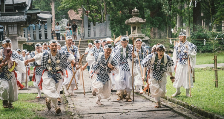
These devout practitioners, known as "shugenja" or "yamabushi," which translates to "ascetics of Shugendo" and "those who lay in the mountains," respectively, embark on retreats into these sacred mountains to seek inner peace, pursue Buddhist enlightenment, and commune with the Shinto gods. Throughout their retreats, the yamabushi engage in a diverse array of rituals aimed at drawing them closer to their spiritual objectives.
Legend has it that these mountain ascetics are bestowed with "supernatural powers" by the mountains themselves, enabling them to heal illnesses and bestow abundant harvests upon the fields. Such beliefs held particular significance in Japan's agricultural regions, where the mountains were regarded as "bestowers of blessings." They were seen as a source of prosperity, with their waters flowing down into the plains and enriching the fields.
We invite you to explore the sacred Dewa Sanzan mountains, delving into the ancient spirituality that has sustained Japan's rural communities and their people for centuries.
“The Journey of Rebirth”
(a Japan Heritage since 2016)
The Yamabushi monks of Dewa Sanzan embark on the sacred pilgrimage of the 'three sacred mountains' to undergo a profound rebirth, emerging as a renewed self. The exploration of each peak unlocks the understanding of a stage in life: present (in Mt. Haguro), past (Mt. Gassan), and future (Mt. Yudono).
In their spiritual practice, they revere nature as a nurturing "mother," with the forests serving as a symbolic maternal womb. It is within this natural sanctuary that pilgrims attain profound wisdom and a heightened state of awakening.
You, too, have the opportunity to embark on this transformative journey by hiking in the mountains, either in solitary reflection or guided by a Yamabushi priest from the Dewa Sanzan shrine.
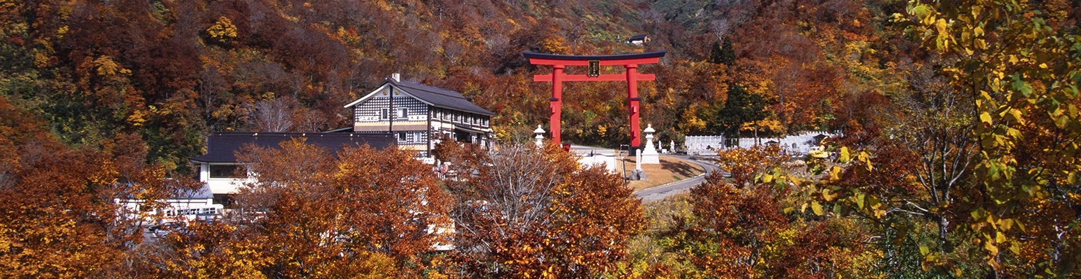
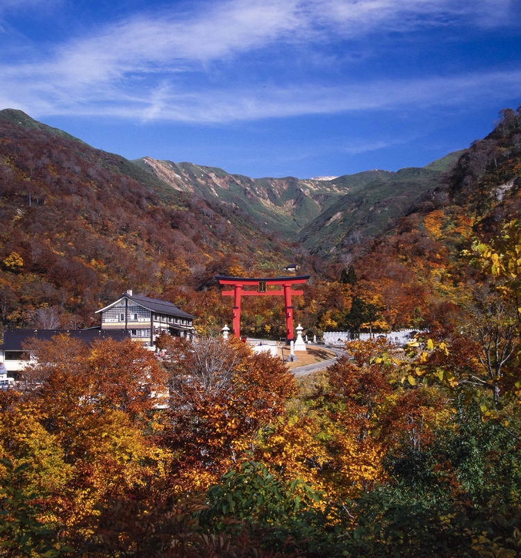
Mt. Haguro
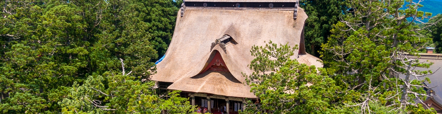
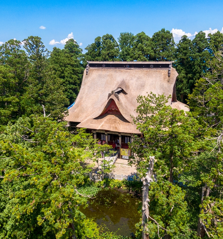
Mt. Haguro is the smallest of the Dewa Sanzan mountains (414m. high), allowing it to be opened to visitors all-year-round regardless of snowfalls. This is why you will find the Dewa Sanzan shrine (Sanjingosaiden) at the top of Mt. Haguro, where the gods of the three different mountains are enshrined all at once.
To explore Mt. Haguro, visitors have the choice between climbing the 2446 stone steps from the Zuishinmon entrance gate to the top, allowing them to see the Five-Storied Pagoda (National Treasure), the 400 years old cedar tree avenue listed as a National Natural Monument, the Minamidani ruins and the teahouse “Ninosaka chaya” (required time: 70-80 minutes); or simply reach the top by bus at the Haguro Sancho bus stop to visit the Dewa Sanzan shrine or eat at Saikan directly (on reservation).
According to legend—as it is told in the manuscript Haguro's Origins (羽黒山縁起), written in 1644—Mt. Haguro was discovered by a mysterious prince named Nojo Taishi 能除太子 (also known as Prince Hachiko) in 593.
See the points of interests in Mt. Haguro
Take part in our tours in Mt. Haguro
Access
Bus timetable (external link to Shonai Kotsu.jp)
- Bus stop name to climb the 2446 stone steps: Hagurozuishinmon 羽黒随神門
- Bus stop name to arrive directly at the top of Mt. Haguro: Haguro Sancho 羽黒山頂
Hiking map
Mt. Gassan
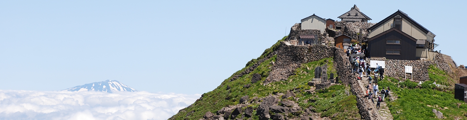
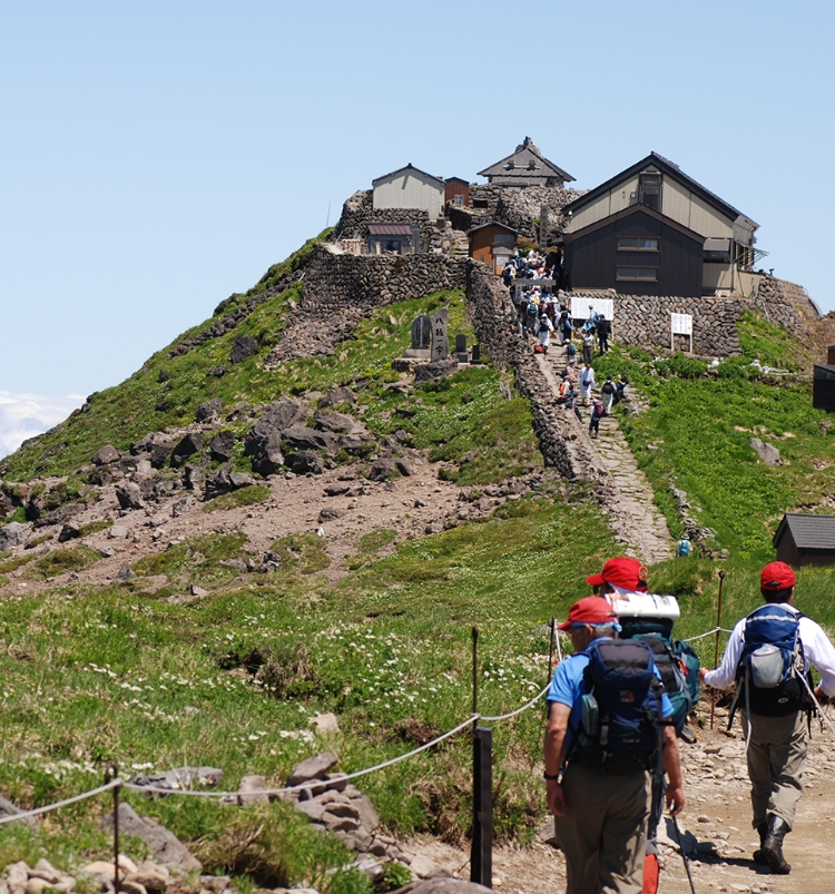
Mt. Gassan, the oldest and tallest peak (1,984m. high) among the Dewa Sanzan, has perpetually stood as the epicenter of the Dewa Sanzan worship practices. As the emblem of the “past,” Mt. Gassan is believed to serve as the eternal resting place for the souls of our forebears, earning it the additional moniker, the "Realm of the Dead.”
Part of the Bandai-Asahi National Park and a National Natural Monument in itself, Mt. Gassan’s many endemic species of flowers and grass are protected by the Japanese government. The hike from Gassan Hachigome’s bus stop to the Gassan-jinja shrine at the peak takes 2 hours and half to complete for beginners. Hikers have the choice to continue their adventure down to Mt. Yudono (3.5 hours, advanced) or go back to Gassan hachigome’s bus stop (2 hours, easy).
See the points of interests in Mt. Gassan
Take part in our tours in Mt. Gassan
Access
Bus timetable (external link to Shonai Kotsu.jp)
- Bus stop name: Gassan hachigome 月山八合目
Hiking map
Mt. Yudono
Originally not part of the Dewa Sanzan, Mt. Yudono (approx. 1,500m. high) was integrated into the sacred trinity in the early 17th century, replacing Mt. Hayama (Sagae City) for geographical survey purposes, which had earlier replaced Mt. Chokai (Sakata City). According to historical accounts, Mt. Yudono was first sanctified as a site of esoteric Buddhism by Kukai, the revered founder of Shingon Buddhism, in the late 8th century. Upon its inclusion in the Dewa Sanzan trio, Mt. Yudono assumed the symbolic representation of "the future," marking the culmination of the transformative "Journey of Rebirth" through the mountains. This explains why it is traditionally the final destination for pilgrims, following the visits to the other two mountains.
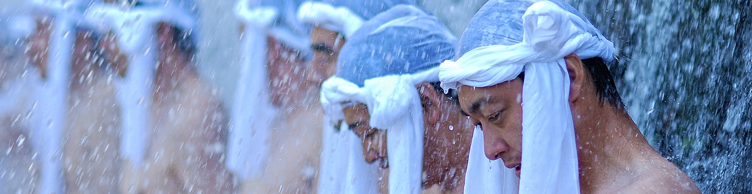
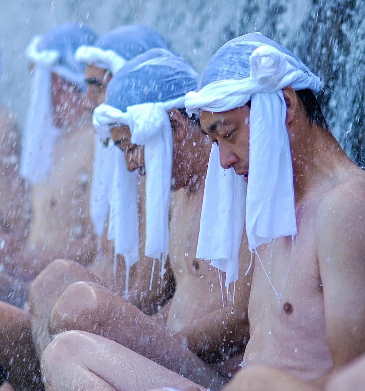
Mt. Yudono itself is believed to embody the concept of rebirth, with its deity residing in a massive red rock from which a hot stream gushes out. Pilgrims are invited to remove their shoes, partake in a purification prayer at the shrine stand (500 yen per person), and wade through the warm waters as a symbolic act of purification and dedication to the future—be it future incarnations, generations, or aspirations.
See the points of interests in Mt. Yudono
Take part in our tours in Mt. Yudono
Access
Bus info (released every year in May) (external link to Shonai Kotsu.jp)
- Bus stop name: Yudonosan senninzawa 湯殿山仙人沢
Hiking map
From Mt. Gassan:
From Honmyoji Temple (the Rokujurigoe Kaido pilgrimage):
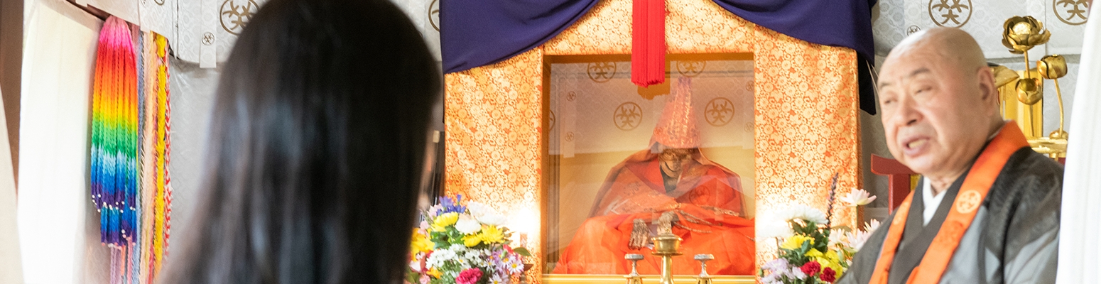
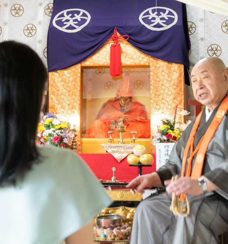
Sokushinbutsu mummies
As surprising as it sounds, Japan, too, has its own mummies. There are 17 mummies in Japan, within which 7 belong to Mt. Yudono's practice of Shingon Buddhism (esoteric Buddhism). 4 of them can be found in Tsuruoka City. In the 17th century, the rivalry between Mt. Haguro and Mt. Yudono led the temples on both mountains to affirm their religious identity: Tendai Buddhist on Mt. Haguro, and Shingon Buddhist on Mt. Yudono. The temples on Mt. Yudono wanted to bring the Sokushinbutsu practice up to date as it was the embodiment of their master’s teachings (Kukai, himself dying as a sokushinbutsu), to counter Mt. Haguro’s demands for Mt. Yudono to convert to their school of Buddhism. This is why you will find so many Sokushinbutsu mummies around Mt. Yudono (11 mummies in a 150km. perimeter around Mt. Yudono out of the 17 mummies in all Japan).
Monks believed mummifying their own bodies would make them experience the most atrocious pain in life, allowing them to become Buddhas so they could protect the people around them. The practice was forbidden by law in 1877. See the temples where you can admire a Sokushinbutsu mummy in Tsuruoka city
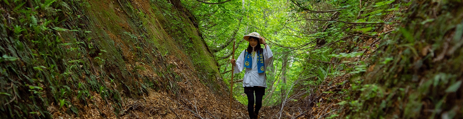
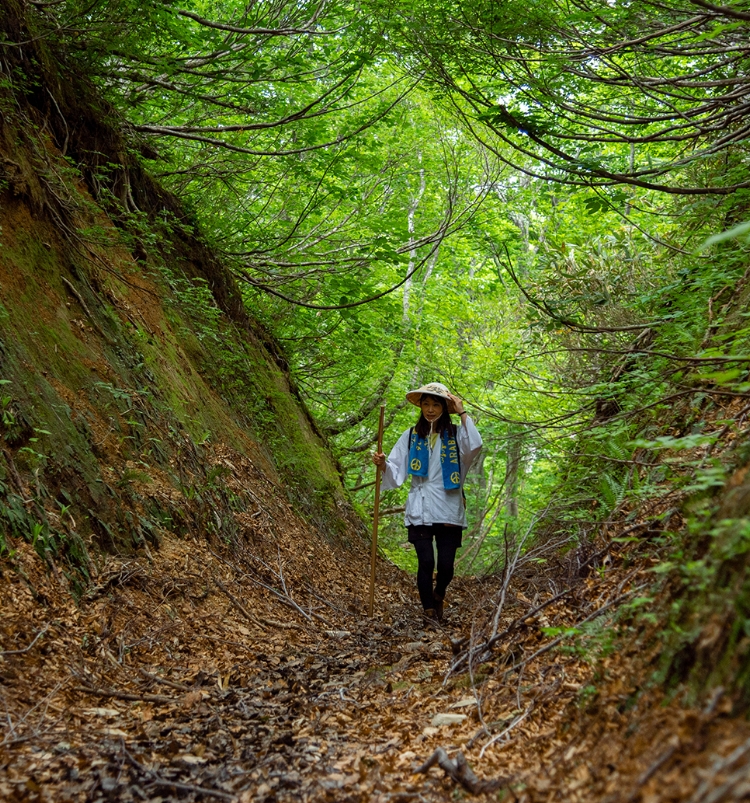
The Rokujurigoe Kaido pilgrimage
The Rokujurigoe kaido 六十里越街道, literally: "the Highway that goes past the Rokujuri", has been named that way after a slope called Rokujuri-zaka 六十里坂. The Rokujurigoe Kaido Pilgrimage trail is estimated to exist since the construction of Churenji (833) and Dainichibo temples (852), the two main temples of Mt. Yudono located in Oami village. In the scrolls named Dewa Fudoki 出羽風土記 written in 1792, it is reported that the pilgrims already walked upon the paths of the Rokujurigoe Kaido since the Nara Period (8th century) to go to Mt. Yudono.
But because it connected the inner lands of Yamagata Prefecture (nairiku 内陸) to the coastal area (shonai 庄内); it was also used for many other reasons than faith.
In fact, it was a convenient road even for the military, that allowed the soldiers from the Shonai region to reach the inner lands when they had to travel and protected the coastal area from powerful attacks thanks to the narrowness of the roads. During the Emishi (native tribes of Northern Japan) revolts in the late 8th century-early 9th century, the Rokujurigoe Kaido was also used by the soldiers to fight the rebels in the North. In 792, General Sakanoue Tamamuro was sent to the lands of Dewa to defeat the Emishi rebels and is said to have followed the Rokujurigoe Kaido trail to travel to the Emishi villages. In the Edo Period (1604-1868), the route was also taken by the Shonai lords and their army to go back to the capital (Edo, current Tokyo) every two years. Merchants and farmers also used the Rokujurigoe Kaido tracks to sell their goods in the cities of the nairiku region.